


Introduction
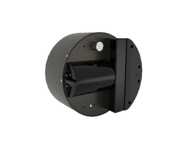
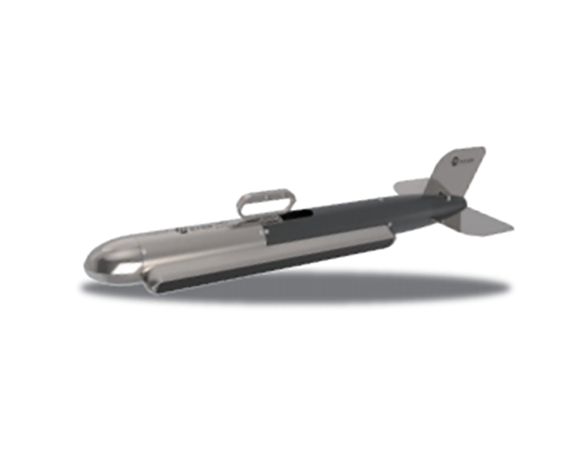
TD-MS400U is an ultra-miniature and highly integrated all-in-one multibeam echo sounder, specially developed for small-sized unmanned surface vehicle (USV) and underwater unmanned device survey applications. It fully integrates the surface sound velocity meter, attitude indicator, GPS, etc. Meanwhile, its various interfaces are developed externally, supporting the synchronous work with other devices.
Features
●Highly integrated functions: It integrates the high-precision satellite positioning system, high-precision attitude indicator and sound velocity meter, which can realize the calibration-free underwater terrain survey and provide the position navigation information for unmanned surface vehicles.
●Full-automatic measurement: Full-automatic measurement free of calibration, parameter adjustment and manual intervention, suitable for all kinds of unmanned platform integration applications.
●Low power consumption & light weight: The whole device power consumption is as low as 70W and the weight is 7.5kg. It is easy to install and can be integrated into all kinds of unmanned surface vehicles such as kayaka, catamaran and trimaran.
●Support for extended applications: Standard attitude, position, time and synchronization data output with independent and extensible network interfaces, support for extended 3D laser scanner, and support for ADCP joint survey, multi-beam echo sounding and side-scan sonar joint survey.
|
Technical specification |
Physical specification |
Features & Functions |
|||
|
Working frequency |
400kHz |
Probe size |
220 x 181 (145+36) mm |
Near field focusing |
Support |
|
Number of beams |
512 |
Array weight |
7.5kg |
Bottom tracking |
Support |
|
Parallel track beam width |
2° |
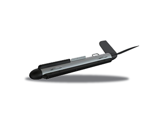
Deck unit size |
200 x 145 x 107mm |
Water body imaging |
Support |
|
Vertical track beam width |
1° |
Deck unit weight |
2.5kg |
Real-time roll stabilization |
Support |
|
Beam angle range |
143° |
Operating/storage temperature |
-2℃~40℃ / -20℃~55℃ |
|
|
|
Sounding range |
0.2~150m |
Power supply |
DC10-32V / AV110-240V |
|
|
|
Depth resolution |
0.75cm |
Power consumption |
70W-90W |
|
|
|
Measurement mode |
Equiangular/equidistance |
|
|
|
|
|
Maximum Ping rate |
60 Hz |
Auxiliary devices |
Software configuration |
||
|
Signal type |
CW/Chirp |
Surface Sound Velocity meter |
External (SVS1500) |
Display control and navigation acquisition software |
Integrated display of HydroNavi Plus water body data and 3D terrain navigation |
|
Pulse width |
30us~8ms |
Sound velocity profiler |
External (SVS1500) optional |
Optional software |
Hypack post-processing software |
|
Compressive strength |
50m |
Attitude indicator |
External (POS25/POS15) optional |
Compatible software |
Acquisition software such as Quinsy, EVIA, Hypack and post-processing software such as Caris |
|
|
|
GPS |
External (POS25/POS15) optional |
Other optional software |
USV development kit |
|
Device type |
POS25 |
|
Heading accuracy |
0.06°, 4m baseline/0.08°, 2m baseline |
|
Attitude accuracy |
0.03°, real-time RTK/0.025°, post-processing |
|
Heave accuracy |
5cm or 5% range; 2cm or 2% range (TrueHeave) |
|
Horizontal positioning accuracy |
±8mm+1ppm (RTK, PPK); 10cm (satellite-based differential, PPP); 0.5~2 cm (DGPS) |
|
Auxiliary positioning accuracy |
Seamless compatible Qianxun, provincial CORS; Post-processing support PPK, PP-RTX |
Introduction TD-SS3060 dual-frequency side-scan sonar is widely used in many fields such as underwater engineering detect...
Introduction TD-SS900 is a single-frequency towed side-scan sonar product designed for inland engineering and waterway de...
Introduction TD-SE200 single-beam echo sounder is a highly cost-effective underwater depth measurement product. It is sui...


Thank you for your message and we will contact you within 24 Hours of your submission to resolve your issue
 Online consultation